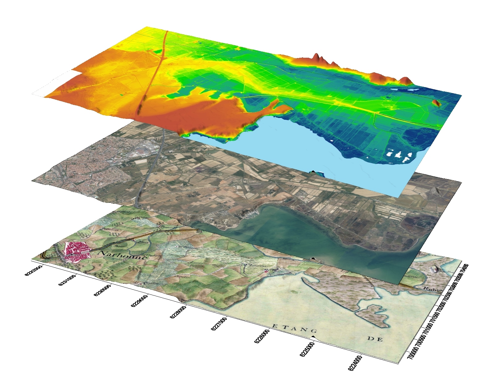
La géomatique repose sur deux piliers complémentaires pour l'analyse des données spatiales : le SIG (Système d'Information Géographique) et la Télédétection.https://elearning.univ-biskra.dz/moodle/pluginfile.php/896175/course/summary/g%C3%A9omatique%20et%20t%C3%A9l%C3%A9detection.docx
- Créateur de cours: Belkacem Boumaraf